Friday, 13 March 2020

The Great North Walk - Mooney Mooney to Quarry Campsite & Return February 2020

This time I did another section of the Great North Walk, from the Mooney Mooney bridge north. Mooney creek was very turbid and I suspect I was the first person along the here after the torrential rains we had just received. The track was muddy and leech infested, a few weeks ago the track would have been dusty, and my lower limbs leech free. 
A deer bounded off as I was parking my ute, I wasn't quick enough to get a photo.
I passed besides the Lower Mooney reservoir, this dam formerly supplied Gosford, the newer Upper Mooney reservoir now supplies the Central Coast.

I was on hands and knees crossing here, slippery.
The Lower Mooney Dam
The Lower Mooney Dam Wall
Ruins of the Lower Mooney Dam Pumping Station
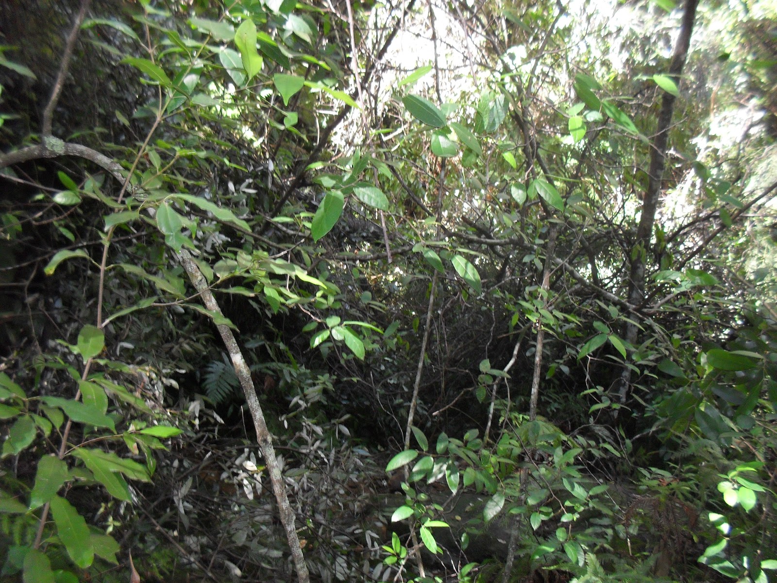
Much of the track was overgrown, the track is meant to pass through here.
The Quarry Campsite, notice the combustible material around the fire place.
A large crayfish in the turbid water
The M1 Motorway Mooney Mooney Bridge
Stats,
distance: 16.7Km
moving time: 3hr, 3min
Elevation: 301metres
Calories:1133


Sunday, 19 January 2020

The Great North Walk - Patonga to Mt Wondabyne & Return December 2019

Not much to report concerning this one. I had some difficulty deciding where to go, there were fires in all directions from Sydney. After studying the fire maps and the National Parks web pages, I settled on the Great North Walk (GNW) section from Patonga to Mt Wondabyne and return. The nearest fire was about 40km away. This is in the Brisbane Waters National Park, a bit further south from section of the GNW that I did in my September 2019.

A creek near Patonga is usually dry at low tide, high tide can mean wet feet
I don't know if this is a recent arrangement or not
Looking towards Woy Woy
Bush fire smoke from the Yengo National Park on the horizon
Patonga
Mouth of the Hawkesbury & Barrenjoey Head
Stats,
distance: 22.6Km
moving time: 4hr, 1min
Elevation: 610metres
Calories:1931


Friday, 6 December 2019

Langi Ghiran - November 2019

Langi Ghiran  or "Lar-ne- Jeering" to the Djab Wurrung people, means home of the black cockatoo. In 1836 Major Mitchell was the first European to climb the mount, he dubbed it Mt Mistake.

Part of Ararat's water supply the Langi Ghiran reservoir was built in 1880. The Mt Cole reservoir is approximately nine kilometers east of Langi Ghiran. A pipeline from the Mt Cole reservoir gravity feeds water to the ridge a kilometre or so from the Langi Ghiran reservoir, the water would then flow down the granite block lined channel to the Langi Ghiran reservoir. This channel is no longer used, a pipeline has been constructed for this purpose.

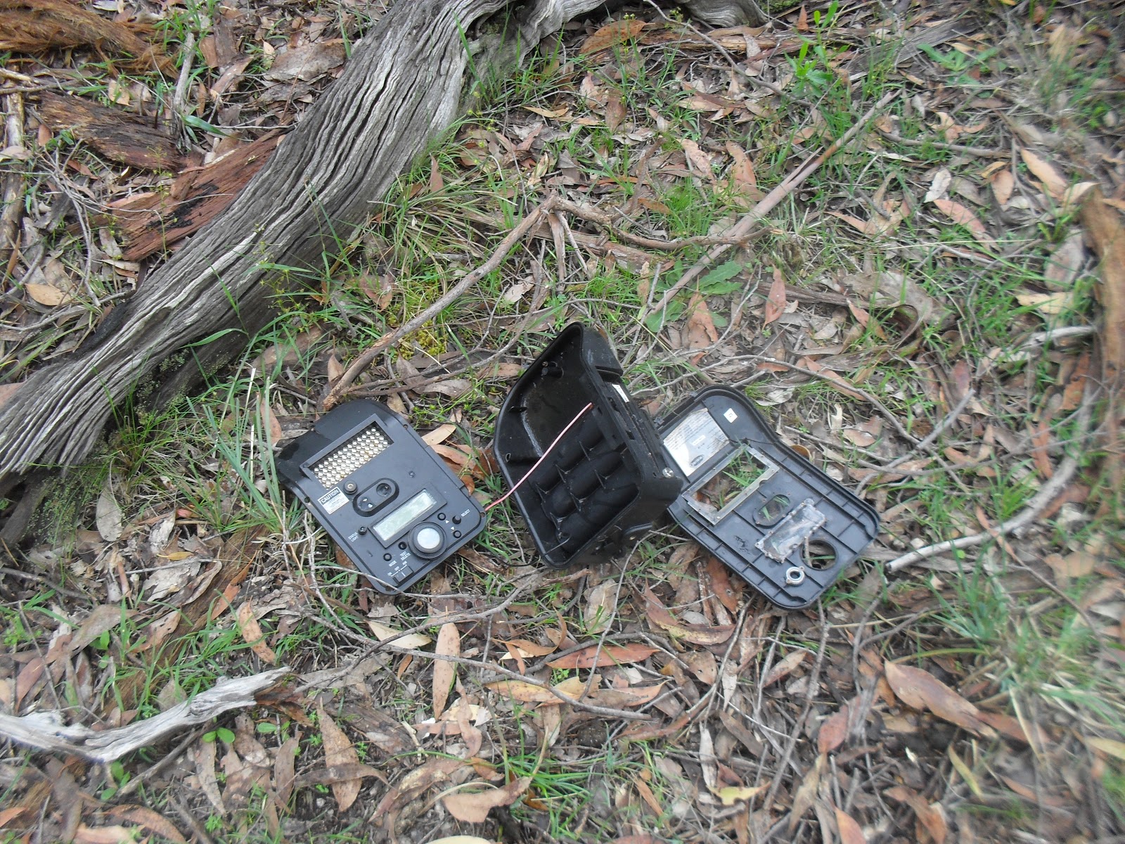
I started off from the picnic ground and camping area. Heading east and clockwise along a walking track, after passing the main reservoir I had planned to follow the disused open channel to the ridge where the the Mt Cole pipeline emerges, I had a little trouble locating the channel, so I was bushbashing until I  picked up the channel. While I was trundling through this off track section, I came upon the smashed wild life camera pictured below.

From the pipe outflow point I was on closed off four wheel drive tracks to within a couple kilometers from the summit, then rock scrambling to the summit and thence to the hidden lagoon. The Hidden lagoon is in the saddle between the Langi Ghiran peak and the lesser peak of Mt Gorrin. From the lagoon It was an easy dirt track back to the car. Then the start of my long drive back to Sydney.


The First Small Dam
A Granite Style near the Small Dam

The Main Reservoir
Somebody doesn't like being videoed

The disused open channel
 
Looking North from the Mt Cole pipeline outflow
The Dry Hidden Lagoon
  
Looking South From Langi Ghiran Summit


Stats,
distance: 16.3Km
moving time: 2hr, 32mins
Elevation: 700metres
Calories:1574


Thursday, 14 November 2019

Tessellate Hill- October 2019

I was looking for something a bit shorter this time. I had heard of the tessellated rock formations a few kilometers north of Mt Irvine and had been thinking of having a look for a while now, so off I went. Mt Irvine is one of many volcanic capped mountains in the Blue Mountains. I continued north along a ridge extending from Mt Irvine. The ridge is bordered in the west by the Wollengambe River and in the east by the Bowen Gorge. The Wollengambe is famous for canyoning. Many years ago we did a lilo trip down the Wollengambe.
Mt Irvine is covered in lush forest. Further north the ridge is sandstone and the vegetation here correspondingly scrubbier. I took a bit of a look further on from the tessellate formation, after a few kilometers or so of bush bashing through the scrub not on a defined track I called it a day and retraced my path back to the car.

Tessellated sandstone
Another Rock Formation

Looking North into The Wollemi Wilderness, the faint Mountain on the horizon is Mt Yengo
Looking across Bowen Creek to Mt Tootie
This creature was enjoying the sun

Wollangambe River


Stats,
distance: 10.9Km
moving time: 2hr, 26mins
Elevation: 391metres
Calories:1862


Tuesday, 15 October 2019

Mooney Mooney to Wondabyne Station & return September 2019

This run started and ended at the Old Pacific Highway Bridge over the Mooney Mooney Creek, below the new multi lane freeway bridge. The out and back route was mostly over a section of The Great North Walk (GNW). The GNW is from the Sydney CBD to Newcastle CBD, a walking distance of approximately 250Km. Details of the GNW can be found here: https://en.wikipedia.org/wiki/Great_North_Walk
Many different species of wildflowers were in bloom, really quite beautiful.
I managed to get close to several Glossy Black Cockatoos, I wasn't able to photograph them.https://en.wikipedia.org/wiki/Glossy_black_cockatoo

The turn around point, Wondabyne railway station. This station is one of the smallest in Australia. The only access to the station is by train, boat or walking, there is no road access. The station was built in 1889 and was previously know as Mullet Station. There is a working sandstone quarry here. This quarry has supplied sandstone for the National War Memorial in Canberra, and recently St Marys Cathedral spire in Sydney.
Usually during September the Terrigal Trotters running club conduct an Ultramarathon on parts of the GNW, the section I did today is used for of this event. Details here: https://www.terrigaltrotters.com.au/GNW/

The Under Belly of the Mooney Mooney Freeway Bridge
The Mooney Mooney Freeway Bridge from the Great North Walk
A Juvenile Goanna
Flannel Flowers
Wondabyne Station

The Intentions Book Container
Mooney Mooney Creek
Suspension Bridge over Piles Creek

Stats,
distance: 20.9 Km
moving time: 3hr, 31mins
Elevation: 637metres
Calories:1862


Monday, 9 September 2019

Heathcote, Karloo Pool, Waterfall & return via Lake Ekersly August 2019

I did this run the day after a dump of snow in the Blue Mountains. I had no desire to go anywhere cold, it turned out a magnificent day for a run in the Royal and Heathcote National Parks. My route passed by several rock pools, these pools in warmer times would have people swimming in them, I didn't meet a sole while in the bush, so close to Sydney. Lots of birds in the banksias and a couple of wallabies where the only wildlife I encountered. This was my last long run before the annual Bilpin Bush Run.

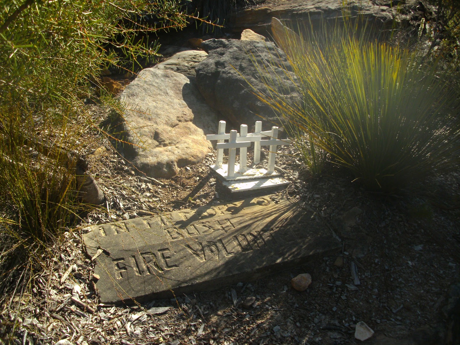
Memorial to Firefighters who died here
Water supply pipeline from Woronora Reservoir
This pipeline from the Woronora Reservoir supplies some southern Sydney suburbs. The reservoir also supplies some northern Wollongong suburbs. The reservoir is heritage listed and took fourteen year to build, commencing  in 1927.
Lake Ekersly (not actually a lake, but a pool in the Woronora River) 

Stats,
distance: 24.4 Km
moving time: 4hr, 1mins
Elevation: 522metres
Calories:2040


Wednesday, 31 July 2019

Wattle Ridge, Slot Way, Nattai River & Troy's Creek July 2019

From Wattle Ridge I took the Slot Way track to access the Nattai River. Needle Lookout is along this track, as the lookout's name suggests it provides a great view of Russell's Needle as well as a good look at this section of the Nattai River Gorge. Russell's Needle is upstream from where the Slot Way meets the river, I wanted to go the opposite way. So down stream I went, the track is virtually non existent along the river.   Progress was a mostly a matter of negotiating a water worn bed of rocks about the size of footballs.   
My route out was via Troy's Creek track and then onto the old Nattai road. Troys Creek track was once an access track to the farm house that was at Emmetts Flat on the river. There is some relics from this farm at the Flat, a rusty old stove and a rusty bed frame.  Troys track at the river is a little hard to find and the track itself is very overgrown, long trousers are recommended. I encountered a few Lyre birds on the way out.


Looking North along the Nattai River Gorge from Needle Lookout
Mt Jellore, with Russell's Needle directly below Mt Jellore, also from Needle Lookout

A better view of Russell's Needle from near the Nattai River
Ruins at Emmett's Flat

Stats,
distance: 20.8 Km
moving time: 3hr, 30mins
Elevation: 694 metres
Calories:1901