![]() |
| Glenbrook Creek |
![]() |
| Rosy Heath-Myrtle (euryomyrtus ramosissima) |
![]() |
| Lost World on the far cliff |
![]() |
| Guinea Flower (hibbertia nemotophylla) |
![]() |
| Glennbrook Creek again |
![]() |
| End of the road |
![]() |
| Glenbrook Creek |
![]() |
| Rosy Heath-Myrtle (euryomyrtus ramosissima) |
![]() |
| Lost World on the far cliff |
![]() |
| Guinea Flower (hibbertia nemotophylla) |
![]() |
| Glennbrook Creek again |
![]() |
| End of the road |
The fertile Mangrove Creek Valley provided farm produce for colonial Sydney. The derelict, heritage listed, Fairview Homestead pictured below is the last to be occupied farm house in the valley. Fairview Homestead and Saint Thomas' Cemetery, also pictured below, are obvious reminders of colonial occupation. Travellers heading for Gosford and the Central Coast went via the Old Great North Road, after crossing Wiseman's Ferry left the Old Great North Road and turned towards the coast along Simpson's Road. I went on part of both those roads on this run. They are now a days they are just trails in the Dharug National park.
![]() |
| Mangrove Creek Valley from Donny's Trail |
![]() |
| Clare's Bridge |
![]() |
| Ten Mile Hollow Camping Ground |
![]() |
| Mangrove Creek Track |
![]() |
| Fairview Homestead |
![]() |
| Saint Thomas' Cemetery |
![]() |
| Saint Thomas' Cemetery |
Mount Bogong is Victoria's highest peak at 1986 metres, just 242 metres lower than Mount Kosciusko. Kosciusko can be seen from Bogong, approximately 90 km away. I was last on Bogong's summit carrying my son, he is now forty two, it would have been about forty years ago. On that occasion we did the Eskdale and Staircase Spur's loop, this time I went up and back via the Staircase, the shortest route from Mountain Creek Campground. It was a warm day and hot work climbing in the trees, once above the tree line the temperature was pleasant and on the top it was decidedly cool. I slept soundly that evening in the basic but beautiful Mountain Creek Campground.
![]() |
| Above the tree line |
![]() |
| Mint Bush (Prostanthera Subalpina) |
![]() |
| Spot the snake (I sighted two) |
![]() |
| Bivouac Hut |
![]() |
| Looking into Keiwa Valley |
![]() |
| Cairn on the summit |
![]() |
| View to the North East (Kosciusko is there somewhere) |
![]() |
| Mountain Creek |
![]() |
| Tasmanian Flax Lily (Dianella Tasmanica) |
![]() |
| Snow Daisy (Celmisia Costiniana) |
Mt Kembla's summit, like the nearby Mt Kiera, is about the same altitude as the escarpment. Both these peaks extend east toward the coast from the escarpment cliff line, towards Wollongong suburbs. The path I took was fire trail, single track with some scrambling and a small section of road. From the top of the escarpment the country gently slopes to the west, this area is part of Sydney's water catchment.
| |
| Moss |
| Find the Monotreme |
| Lake Illawarra |
| Port Kembla |
| On the Summit Walk |
| South along the Escarpment |
Just a short one this time. From Blaxland to Bullant Lookout, and then back via Florabella Pass. Florabella Pass is a walking track which is high on the side of Glenbrook Creek Gorge. I emerging from the bush and onto the Great Western Highway a kilometer or so west of Blaxland. Having completed this with time to spare, so on the way home I stopped next the western bank of the Nepean River and hiked upstream to where Glenbrook Creek joins the Nepean River. The last two pictures were taken on this walk.
![]() |
| Glenbrook Creek from Bullant Lookout |
![]() |
| Hairy Wax Flower (philotheca hispidula) |
![]() |
| Pink Spider Flower (grevillea sericea) |
![]() |
| Looking upstream into the Nepean River Gorge |
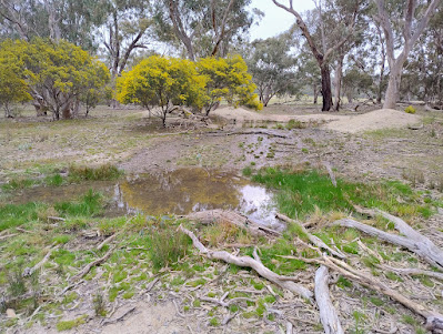
First up was a visit to the White Swan Quartz Crystal Mine, this mine had two periods of operation, the first being in the 1920s, the quartz was then used on graves. The second period in the 40s the mine was made an "open cut", the crystal was at that time extracted for AWA to use in radios for the war effort. I then scrub bashed to the summit of Mt Koorooya. On the northern side of the mount is a huge granite rock face. This rock face is at least higher then one hundred metres. After the summit I followed the ridge west, eventually dropping to flat lightly wooded land and making my way back to the car the long way, this involved some "off piste", bush bashing. It was a nostalgic run back, passing the spring/soak where two mates and I camped around sixty years ago. In 1954 a small uneconomic deposit of Torbernite, an ore of uranium was found in the park. Next time I am here I'll have a look for it.
![]() |
| The White Swan Crystal Mine |
![]() |
| Mt Kooyoora from the Crystal Mine |
![]() |
| Flowering throughout the park was, Wallowa acacia euthycarpa |
![]() |
| The ridge west from the summit |
![]() |
| Swamp Wallaby |
![]() |
| The Rock Face, the picture doesn't convey the height |
![]() |
| The soak, where three lads camped |
![]() |
| I would like to know how old it is. |