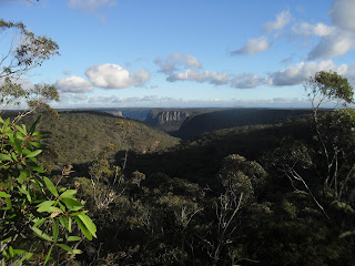
My route out was via Troy's Creek track and then onto the old Nattai road. Troys Creek track was once an access track to the farm house that was at Emmetts Flat on the river. There is some relics from this farm at the Flat, a rusty old stove and a rusty bed frame. Troys track at the river is a little hard to find and the track itself is very overgrown, long trousers are recommended. I encountered a few Lyre birds on the way out.
 |
| Looking North along the Nattai River Gorge from Needle Lookout |
 |
| Mt Jellore, with Russell's Needle directly below Mt Jellore, also from Needle Lookout |
 |
| A better view of Russell's Needle from near the Nattai River |
 |
| Ruins at Emmett's Flat |
Stats,
distance: 20.8 Km
moving time: 3hr, 30mins
Elevation: 694 metres
Calories:1901
No comments:
Post a Comment