This is my second attempt at this route, my last attempt in November 2018 I turned back around midday due to storms brewing. Then I figured I would not reach a suitable campsite before the storms hit. This time the weather was quite different with sunny days and cold nights. The temperature was predicted to drop to -5 overnight in the region. This was the the shortest day of the year, to enable maximum walking time I slept in the back of the ute the night before. I don't know what the temperature did drop to, but I woke to find my water bottle had ice in it. The rest of the day turned out to be perfect for hiking. After an uneventful day of walking I arriving at Mt Cloudmaker just before nightfall. After entering my intentions in the log book, I doubled back 100 metres or so, to a sheltered saddle, where I set up camp. After a feed I was tucked in my sleeping bag by 6pm, it was just too cold. The next morning, after a good and long nights sleep my water bottle had ice in it again. It was a bit chilly getting breakfast, as soon as I got hiking I warmed up. The weather remained perfect for the rest of this day also.
Mt Cloudmaker is the highest peak, the route I took follows the ridges. I could just see Sydney CBD from where I took this.
Looking up Gordon Smiths Pass
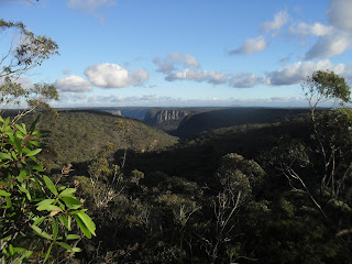
Looking West to Back to Kanangra Walls
My camp, near the of summit of Mt Cloudmaker
Mt Cloudmaker summit
Cave at the base of Crafts Wall
Looking South from the Kanangra-Boyd Plateau, Mt Colong on the horizon
Ice on the puddles at 4pm
Stats,
Kanangra Walls to Mt Cloudmaker
distance: 11.6 Km
moving time: 4hr, 17mins
total time: 6hr, 50mins
Elevation: 704 metres
The return walk
distance: 12 Km
moving time: 4hr, 27mins
total time: 8hr, 21mins
Elevation: 663 metres
Subscribe to Ramblings of a Worn Out Bush Runner by Email


