Tuesday, 1 July 2025

Down the Slott Way to the Nattai River returning via Starlights Track - June 2025

One of my favourites, the Nattai River. The last time I was in this area was in 2020, immediately after the extensive bush fires in the region. 
Here is my post from that time: https://oldbushrunner.blogspot.com/2020/07/wattle-ridge-troys-creek-starlights.html
The vegetation at that time was devastated, quiet eirie to witness. This time the under story had regrown and almost overgrown the tracks. 

(click on the pictures for more detail)

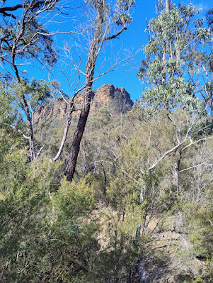
The Nattai is in that gorge

A fresh rockfall on the Slott way

Mt Jellore sticking up mid picture

Russells Needle

Eastern edge of the Nattai Gorge

The Nattai River

Aheaarns Lookout, between the Slott Way & Starlights Track

distance: 18.7Km,  moving time: 3hrs,41mins, elevation: 620metre  

Sunday, 11 May 2025

Wollangambe Crater - April 2025

Wollangambe Crater is an amphitheatre like depression in the wilderness area, adjacent to the Wollangambe River. It is not an impact crater, it was formed from erosion of the softer sandstone by water. This track starts near Bell railway station and is an out and back run/walk. Some distance downstream from where I crossed the Wollangambe river, the river descends into a series of canyons that are among the most popular canyoning canyons in NSW. You may have noticed in the media in January 2024, of deaths of two women in this canyon. One was a police woman who was attempting to rescue the other. Rest assured my crossing of the river was not at all dangerous, a easy three or four steps through a shallow, sandy bottomed, gently flowing river. (click on the links in the text for further details)

(click on the pictures for more detail)

Bell Station is on the far ridge
 
Red-Headed Mouse Spider (missulena occatoria) 

It's venom is believed to be very toxic, very few cases of envenomation have been recorded.  Funnel web antivenom has been successful in one confirmed case.


This was a little scary to negotiate

Goochs Crater is behind the middle ridge 
The Wollengambe River near the Crater


In the Crater

The bright green mid picture is the crater from a kilometer or so away

distance: 20Km,  moving time: 4hrs,8mins, elevation: 741metre

Monday, 21 April 2025

Wodi Wodi Track - Illawarra Escarpment - April 2025

 Along the Illawarra Escarpment, magnificent views of the coastline, the Sea Cliff Bridge and the  Coalcliff Colliery  are two  features. To get down from the top at sublime point meant climbing down several ladders.  (click on the links in the text for further details)

(click on the pictures for more detail)


The Sea Cliff Bridge
Coal Cliff Colliery closed 1991 after 114 years of mining
Wombarra & Coledale
South towards Wollongong
Ladder & Steps on the path
Wombarra Rock Pool

 distance: 19.1Km  
 moving time: 2hrs,55mins
 elevation: 588metre

Sunday, 23 March 2025

Glow Worm Tunnel & Old Coach Road - March 2025

The Glow Worm Tunnel is one of two tunnels on the old railway line from Newnes to the Main Western Line at Newnes Junction. The line 51 kilometres long operated from 1907 until 1932. It was used to carry shale oil, and some passengers, from the Glen Davies Shale Oil Refinery. Most of the line has been ripped up now, the access road follows sections of the line, the access road passes thorough the 'Number Two Tunnel'. 

(click on the links in the text for more details)

No2 Tunnel
Tree Goanna or Lace Monitor (Varanus varius)
South Portal
South Portal
North Portal
Donkey Mountain
National Parks are ensuring these rocks will not fall
North Portal  

 distance: 10.1Km  
moving time: 1hrs,31mins
elevation: 262metre
 

Tuesday, 25 February 2025

Florabella Pass & Green's Road Lookout - February 2025

Green's Road Lookout is a hidden gem in the lower Blue Mountains, it is not marked on most maps and access is relatively easy along Green's Road. I added a little extra by starting at the Warrimoo end of Florabella pass and then diverting to Green's Road.  I returned via Greens Road and the streets of Warrimoo. Last year I did a section of the other end Florabella Pass. 


Glenbrook Creek
Rosy Heath-Myrtle (euryomyrtus ramosissima)

Lost World on the far cliff
Guinea Flower (hibbertia nemotophylla)
Glennbrook Creek again
End of the road

 distance: 10.2Km  
moving time: 1hrs,58mins
elevation: 327metre


Saturday, 1 February 2025

Mangrove Creek - Ten Mile Hollow - January 2025

 The fertile Mangrove Creek Valley provided farm produce for colonial Sydney. The derelict, heritage listed, Fairview Homestead pictured below is the last to be occupied farm house in the valley. Fairview Homestead and Saint Thomas' Cemetery, also pictured below, are obvious reminders of colonial occupation. Travellers heading for Gosford and the Central Coast went via the Old Great North Road, after crossing Wiseman's Ferry left the Old Great North Road and turned towards the coast along Simpson's Road. I went on part of both those roads on this run. They are now a days they are just trails in the Dharug National park.

Mangrove Creek Valley from Donny's Trail

Clare's Bridge
Ten Mile Hollow Camping Ground
Mangrove Creek Track
Fairview Homestead
Saint Thomas' Cemetery
 
distance: 24.9Km  
moving time: 4hrs,18mins
elevation: 548metre