Tuesday, 15 October 2019

Mooney Mooney to Wondabyne Station & return September 2019

This run started and ended at the Old Pacific Highway Bridge over the Mooney Mooney Creek, below the new multi lane freeway bridge. The out and back route was mostly over a section of The Great North Walk (GNW). The GNW is from the Sydney CBD to Newcastle CBD, a walking distance of approximately 250Km. Details of the GNW can be found here: https://en.wikipedia.org/wiki/Great_North_Walk
Many different species of wildflowers were in bloom, really quite beautiful.
I managed to get close to several Glossy Black Cockatoos, I wasn't able to photograph them.https://en.wikipedia.org/wiki/Glossy_black_cockatoo

The turn around point, Wondabyne railway station. This station is one of the smallest in Australia. The only access to the station is by train, boat or walking, there is no road access. The station was built in 1889 and was previously know as Mullet Station. There is a working sandstone quarry here. This quarry has supplied sandstone for the National War Memorial in Canberra, and recently St Marys Cathedral spire in Sydney.
Usually during September the Terrigal Trotters running club conduct an Ultramarathon on parts of the GNW, the section I did today is used for of this event. Details here: https://www.terrigaltrotters.com.au/GNW/

The Under Belly of the Mooney Mooney Freeway Bridge
The Mooney Mooney Freeway Bridge from the Great North Walk
A Juvenile Goanna
Flannel Flowers
Wondabyne Station

The Intentions Book Container
Mooney Mooney Creek
Suspension Bridge over Piles Creek

Stats,
distance: 20.9 Km
moving time: 3hr, 31mins
Elevation: 637metres
Calories:1862


Monday, 9 September 2019

Heathcote, Karloo Pool, Waterfall & return via Lake Ekersly August 2019

I did this run the day after a dump of snow in the Blue Mountains. I had no desire to go anywhere cold, it turned out a magnificent day for a run in the Royal and Heathcote National Parks. My route passed by several rock pools, these pools in warmer times would have people swimming in them, I didn't meet a sole while in the bush, so close to Sydney. Lots of birds in the banksias and a couple of wallabies where the only wildlife I encountered. This was my last long run before the annual Bilpin Bush Run.

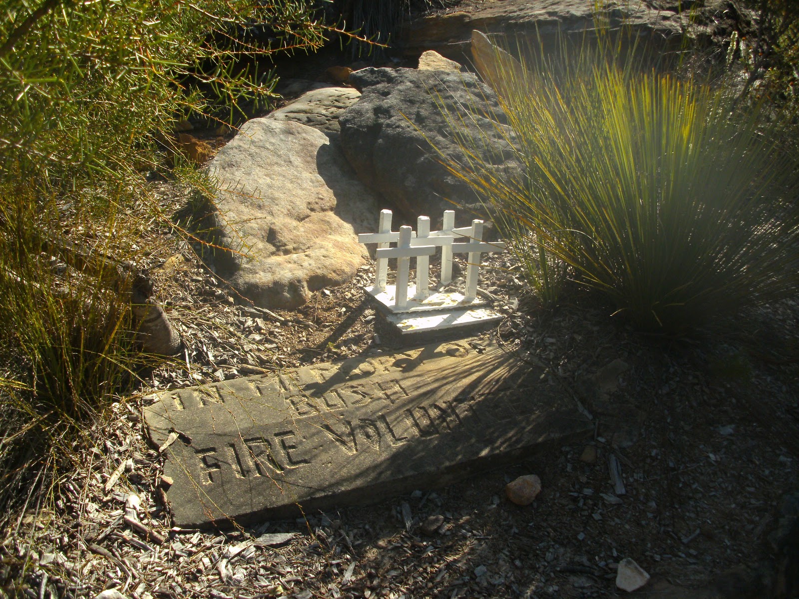
Memorial to Firefighters who died here
Water supply pipeline from Woronora Reservoir
This pipeline from the Woronora Reservoir supplies some southern Sydney suburbs. The reservoir also supplies some northern Wollongong suburbs. The reservoir is heritage listed and took fourteen year to build, commencing  in 1927.
Lake Ekersly (not actually a lake, but a pool in the Woronora River) 

Stats,
distance: 24.4 Km
moving time: 4hr, 1mins
Elevation: 522metres
Calories:2040


Wednesday, 31 July 2019

Wattle Ridge, Slot Way, Nattai River & Troy's Creek July 2019

From Wattle Ridge I took the Slot Way track to access the Nattai River. Needle Lookout is along this track, as the lookout's name suggests it provides a great view of Russell's Needle as well as a good look at this section of the Nattai River Gorge. Russell's Needle is upstream from where the Slot Way meets the river, I wanted to go the opposite way. So down stream I went, the track is virtually non existent along the river.   Progress was a mostly a matter of negotiating a water worn bed of rocks about the size of footballs.   
My route out was via Troy's Creek track and then onto the old Nattai road. Troys Creek track was once an access track to the farm house that was at Emmetts Flat on the river. There is some relics from this farm at the Flat, a rusty old stove and a rusty bed frame.  Troys track at the river is a little hard to find and the track itself is very overgrown, long trousers are recommended. I encountered a few Lyre birds on the way out.


Looking North along the Nattai River Gorge from Needle Lookout
Mt Jellore, with Russell's Needle directly below Mt Jellore, also from Needle Lookout

A better view of Russell's Needle from near the Nattai River
Ruins at Emmett's Flat

Stats,
distance: 20.8 Km
moving time: 3hr, 30mins
Elevation: 694 metres
Calories:1901


Wednesday, 10 July 2019

Overnight on Mount Cloudmaker June 2019

This is my second attempt at this route, my last attempt in November 2018 I turned back around midday due to storms brewing. Then I figured I would not reach a suitable campsite before the storms hit. This time the weather was quite different with sunny days and cold nights.  The temperature was predicted to drop to -5 overnight in the region. This was the the shortest day of the year, to enable maximum walking time I slept in the back of the ute the night before. I don't know what the temperature did drop to, but I woke to find my water bottle had ice in it. The rest of the day turned out to be perfect for hiking. After an uneventful day of walking I arriving at Mt Cloudmaker just before nightfall. After entering my intentions in the log book,  I doubled back 100 metres or so, to a sheltered saddle, where I set up camp. After a feed I was tucked in my sleeping bag by 6pm, it was just too cold. The next morning, after a good and long nights sleep my water bottle had ice in it again. It was a bit chilly getting breakfast, as soon as I got hiking I warmed up. The weather remained perfect for the rest of this day also.

 Mt Cloudmaker is the highest peak, the route I took follows the ridges. I could just see Sydney CBD from where I took this.

Looking up Gordon Smiths Pass

Looking West to Back to Kanangra Walls

My camp, near the of summit of Mt Cloudmaker

Mt Cloudmaker summit

Cave at the base of Crafts Wall

Looking  South from the Kanangra-Boyd Plateau, Mt Colong on the horizon

Ice on the puddles at 4pm


Stats,
Kanangra Walls to Mt Cloudmaker
distance: 11.6 Km
moving time: 4hr, 17mins
total time: 6hr, 50mins
Elevation: 704 metres


The return walk
distance: 12 Km
moving time: 4hr, 27mins
total time: 8hr, 21mins
Elevation: 663 metres

Subscribe to Ramblings of a Worn Out Bush Runner by Email

Tuesday, 21 May 2019

Box Vale Tramway, Nattai River & Forty Foot Falls May 2019


After a break from my bush excursions I was looking for something less arduous, as it turned out I was a still a little sore the next day after doing this one.
The first four and a half kilometres was along the long removed Box Vale Colliery train line route. This line operated for eight years, closing in 1896. The line has a 84 metre tunnel on it. At its peak in  1888, 100 tons per week of coal was hauled along the line, that was during a Melbourne coal strike.
The coal seam is 158 metres below the northern terminus of the line, and is 25 feet thick of very high grade coal. The coal was hauled from mine to the line via a steep incline, that incline is part of the route I took.
After a quick stop to take in the view from the Nattai Gorge lookout, I descended the incline using the  cable  for assistance. On reaching the Nattai river I followed it upstream until the confluence of the Nattai creek, then up the Nattai creek passing Forty Foot Falls. The rest was fire trails back to the car park.

Nattai Creek down below the dam wall

Welby Reservoir, built to supply Mittagong

One of many cuttings along the train line
  

Looking North along the Nattai Gorge towards the Blue Mountains
  

 The Tunnel
 

The steep incline connecting the mine to train line and cable to assist walkers

Nattai River

Another tunnel  (cave)
 

Stats,
distance: 13.3 Km
moving time: 2hr, 6mins
Elevation: 513 metres
Calories:1269


Tuesday, 2 April 2019

Bruce's Walk, Lockleys Pylon, Rodriguez & Pilchers Passes March 2019

The first part of this run was along Bruce's Walk.  Bruce's walk follows the original power lines from Blackheath to Lawson. The power was generated at Lithgow further west, and this line transferred power east. Bruce's walk was constructed in the 1930's and has been very much neglected over recent times. Here is a wikipedia page on the walk https://en.wikipedia.org/wiki/Bruce%27s_Walk. The rest of this excursion was along well known and documented walking tracks as well as the Mt Hay dirt road. Earlier on I had two close snake encounters, I guess these fellows were soaking up the last of the summer sun. After this I didn't hurry and made a lot of noise through the denser undergrowth areas, particularly where I couldn't see the path due the overhanging ferns, luckily I didn't see any more serpents, but who knows how many snakes I passed but I didn't see . Otherwise this was a most enjoyable but long day in the bush.

The original unmaintained handrail & path on Bruce's


Bruce's Walk at the Katoomba Creek crossing 

A sign en route


Looking NW along Bruce's walk


The Grose River is in the valley in the middle of the picture. It is flowing east toward the Hawksbury river taken from near Lockleys Pylon

Looking down on Govetts Creek taken from near Du Faur Head


Du Faur Head is on the left, taken from Govetts Creek

The Junction of the Grose River & Govetts Creek

Log crossing of Govetts Creek

Yellow Slime Mould fuligo septica (dog vomit funghi)

Rodriguez Pass

violet juvenile leaves


Stats,
distance: 28.5 Km
moving time: 4hr, 48mins
Elevation: 1272 metres
Calories:2755


Monday, 11 March 2019

Mt Jellore February 2019

Todays subject, Mt Jellore in the Nattai Wilderness Area is roughly 12km north west of Mittagong and 100km south west of the Sydney CBD. At 800 metres, this distinctive peak is visible from the Sydney CBD and many other high locations in and around Sydney, it is  one of the highest points in this area. It was formed from an intrusion of Trachyte (igneous rock) into the surrounding sandstone.

Looking toward the CBD, a bit too hazy to see the CBD today. The Nattai River is in the gorge in middle of the picture.

Exposed trachyte cliff face on the south side of the mountain

Jellore summit from the access track

Subscribe to Ramblings of a Worn Out Bush Runner by Email

Stats,
distance: 11.3 Km
moving time: 1hr, 54mins
Elevation: 457 metres
Calories: 1095