Saturday, 17 February 2024

Mount Portal - February 2024

I had hoped to be able to do an anticlockwise loop from Glenbrook to the Portal Lookout, and then climb down the face of the Portal Lookout, and back through the streets to my car via Lapstone. Many years ago I had climbed the Portal face. I started this time with the though I could opt out if I thought it was too hard, indeed it was too scary for this old fella. I chose to get back to Glenbrook via the park, but a different route.

The tramway pictured below was used to convey workers, materials and equipment for the construction of the main railway line and tunnel through the Glenbrook Gorge.
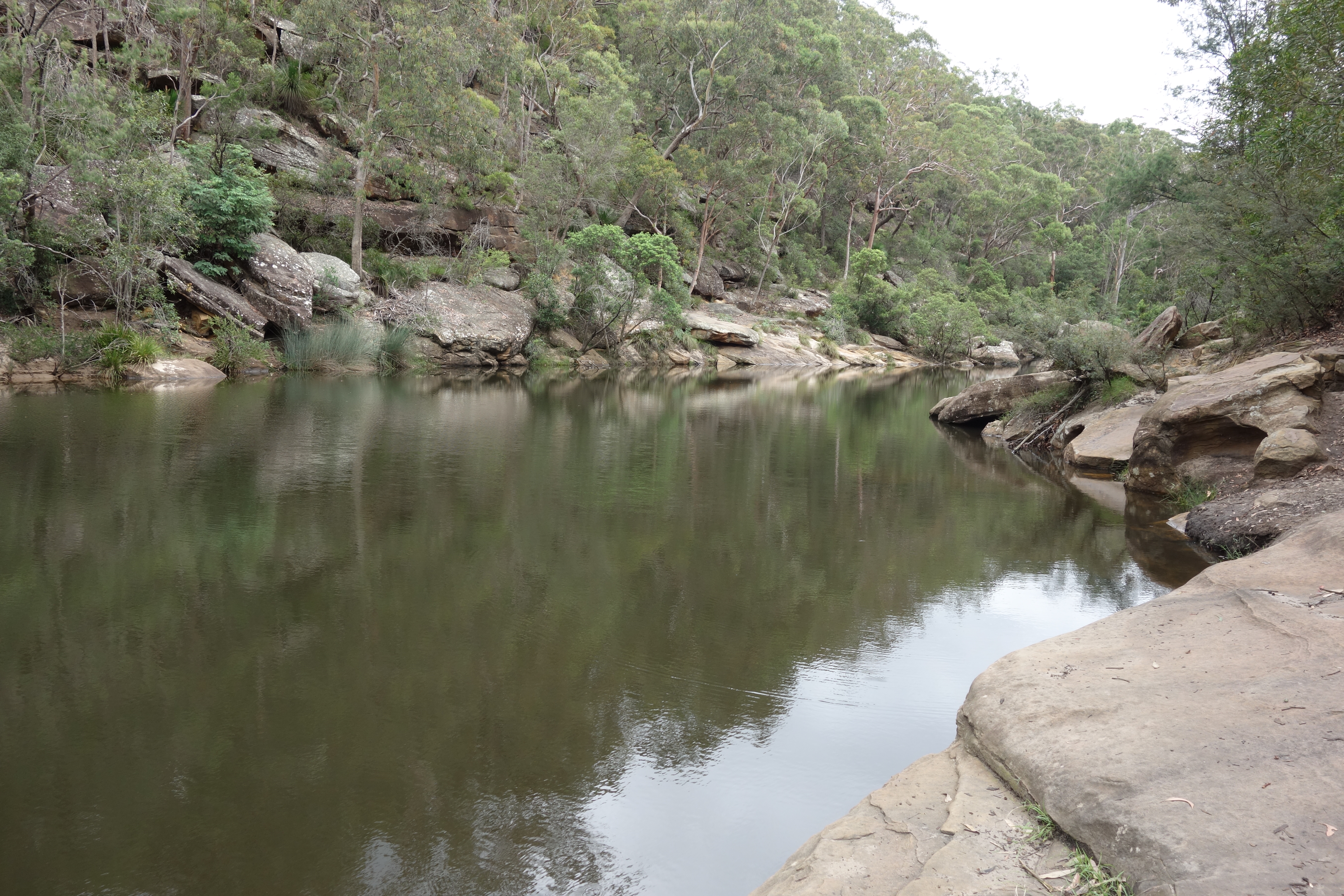
The Jelly Bean Pool, a popular swimming hole

Glenbrook Creek crossing

Glenbrook Creek from Tunnel Lookout

Eastern entrance to the train tunnel over there

The Creek crossing in the slot

Glenbook Creek joins the Nepean, Penrith in far ground

Lyre bird near the National Park entrance

Old tramway route through Darks Common Reserve
Stats, 
distance: 15.8Km  
moving time: 2hr, 28min 
elevation: 539metre      

Monday, 8 January 2024

Cunninghams Gap to Bare Rock & return - January 2024

Cunninghams Gap is only an hour or so west of Brisbane on the busy Cunningham Highway. Several spectacular walks can be accessed here. It can be difficult to find a park, the spot is so popular with walkers. And so it was today, a short wait for a park. I encountered lots day walkers on the shorter walks, after about four km I was virtually on my own. I noticed a tiny brown snake disappear off the track on my way back.


Mt Mitchell & the Cunningham Hwy

The Scenic Rim North of Bare Rock
A Spring on the Mountain

South from Bare Rock


Mt Cordeaux


A Goldless Gold Mine

Stats, 
distance: 13.3Km  
moving time: 1hr, 47min 
elevation: 510metre 

Friday, 29 December 2023

Grose Head South via The Blue Gum Swamp - December 2023

Today's run was to Grose Head South from the west. The last time was from the East. I did that in July 2022, here is the link to that blog entry:  Grose Head South From Yarramundi
I drove home via Mitchell Pass, crossing the heritage listed Lennox Bridge. This bridge is the oldest stone bridge in mainland Australia, and Mitchell Pass is the first road to be constructed on the Eastern slopes of the Blue Mountains.
Here is a link to a 3D view of the route I ran: Fatmap I am not sure that it will work correctly, in any case there is a Google Maps view at the bottom of this post.
 
Memorial to Firemen


Blue Gum Swamp
I think it might be a brown snake

A rock slide on Grose Head South

Purple Snake Flower (Scaevola ramosissima)

Trig on Grose Head South

Lennox Bridge

Plaque at the Lennox Bridge


Stats, 
distance: 16.7Km  
moving time: 2hr, 47min 
elevation: 525metre 

Sunday, 20 August 2023

Bowen Mountain to Bulcamatta Falls & Return - August 2023

 I started at Bowen Mountain. Bowen Mountain is perched on top of a section the Lapstone Monocline the east most edge of the Blue Mountains. After passing the Crago Oberservatory  and a few ups and downs along nicely maintained four wheel drive roads I arrived at the National Parks basic Burralow Creek Picnic and Camp site. Bulcamatta Falls is a further one and a half kilometres along an easy walking track from the picnic ground. I returned via an unmaintained steep and eroded goat track and then onto the easy four wheel drive roads.

Astronomical Society of NSW Observatory 


Unsure what this old structure is


Bucamatta Falls


Burralow Campground & Mt Tomah

Stats, 
distance: 14.3Km  
moving time: 2hr, 19min  
elevation: 417metre

Saturday, 29 July 2023

Dombarton Tunnel, the tunnel to nowwhere - July 2023

The partially built Maldon Dombarton railway line was to transport coal from near Camden to Port at Wollongong.  Construction started 1983, work stopped 1988.
 The tunnel was to allow trains to negotiate the Illawarra escarpment, work stopped with the tunnel less than one hundred metres into the rock, when completed, it was to be the longest rail tunnel in Australia at approximately four kilometres. An operating rail line passes beside the eastern tunnel portal, this line brings coal from further south into Wollongong, the Maldon line was to be parallel to the working line from the tunnel to Wollongong. The Maldon Dombarton line easement is visible on Google Earth satellite images.  
 
Mount Kembla

The Tunnel is directly above the green mound

Lake Illawarra from track side

Track side vegetation

Eastern Tunnel Portal

Looking out


Stats, 
distance: 14Km  
moving time: 2hr, 08min  
elevation: 281metre

Saturday, 24 June 2023

The Hidden Castle of Calabash - June 2023

There are various stories regarding the origin of these ruins, some suggest it was a hotel, others dispute this. Most agree it was completed in 1900, and habitable for twenty or so years when it was abandoned. Some of the graffiti on the walls is marked 1931. The site can be accessed by water and then scrambling up steep track, or walking down a sometimes steep and rough fire trail. National Parks have installed a gate at the entrance to the fire trail, blocking vehicular access.

b
An extremely steep & rough section of track

A rusting Falcon at the bottom of the above section of track

Red Five-Corners (styphelia tubiflora)

Berowra Creek 

The Ruins

Another view

On the Berowra Waters car ferry

Stats, 
distance: 7.7Km  
moving time: 2hr, 07min  
elevation: 176metre

Sunday, 28 May 2023

Deep Pass - May 2023

Deep Pass is a walk in wild camping area near the western boundary of the Wollemi National Park. The Nayook Creek has eroded a gorge into Newnes Plateau. The Deep Pass camping ground is a clearing in a wider section of that gorge. Hard to believe now, prior to being declared national park the previous lease holder used to grow potatoes in the clearing. I noticed horse hoof marks along the entry track. Later at home, further research revealed that wild horse numbers have been increasing in the area lately.

Nayook Creek disappearing underground


Split Rock see my walking poles for scale


Looking into Nayook Canyon towards the pool in the image below


Nayook Canyon as far as I got upstream


Deep Pass Campground


Stats, 
distance: 8.2Km  
moving time: 2hr, 52min  
elevation: 353metre