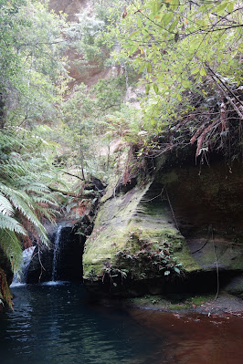
Deep Pass is a walk in wild camping area near the western boundary of the Wollemi National Park. The Nayook Creek has eroded a gorge into Newnes Plateau. The Deep Pass camping ground is a clearing in a wider section of that gorge. Hard to believe now, prior to being declared national park the previous lease holder used to grow potatoes in the clearing. I noticed horse hoof marks along the entry track. Later at home, further research revealed that wild horse numbers have been increasing in the area lately.
Sunday, 28 May 2023




Tuesday, 14 March 2023
Macedon Ranges Walking Track - March 2023
Over the years I have driven past Mount Macedon many times, now seemed like a good opportunity to explore. The Macedon Ranges Walking Track does a loop encompassing Mount Macedon summit with the memorial cross, tourist shop and car park. It passes near the Camels Hump on the northern end of the park, there is a side track to the lookout on the Camels Hump with views to the north and west. Hanging Rock of picnic fame, is clearly visible from here. The track passes through several picnic grounds and the rocky summit of Mount Towrong. From Mount Towrong you can see across the valley to the cross on Mount Macedon.
 |
| The Cross from The Goat Track |
 |
| The Cross from the tourist path |
 |
| Red Lichen on dead wattle trees |
 |
| No Picnic at Hanging Rock today (mid picture) |

 |
| Sanatorium Lake |
 |
| Mount Towrong Summit |
 |
| Looking across to The Cross |

Stats,
distance: 18.5Km
moving time: 3hr, 6min
elevation: 758metre Thursday, 23 February 2023
Mount Keira & Robertson Lookout - February 2023
There are superb views of Wollongong from Robertson Lookout, this lookout is on the eastern edge of the Illawarra Escarpment. I walked this with walking poles as a test to see how my knee was recovering after injuring it a few days ago. I suspect I injured the knee by overextending it. As the day wore on the sore knee seemed to improve and now it is almost fully recovered. The ginger plant flower pictured below is the Kahili Ginger (hedychium gardnerianum). A native of the Himalayas and one of the most invasive plants of the world. There are many of these along the track. Further along I brushed my forearm against some leaves of the Giant Stinging tree (Dendrocnide excelsa) similar pain to stinging nettles but worse and the pain persists for longer, maybe that's why my knee felt much better toward the end of the walk.
 |
| Wollongong |
 |
| Mt Keira from Robertson Lookout |
 |
| Native Violet (viola henderacea) |
 |
| Kahili Ginger (hedychium gardnerianum) |

Stats,
distance: 8.1Km
moving time: 2hr, 44min
elevation: 329metre Tuesday, 31 January 2023
Falconbridge Ridge - January 2023
Another excuse to go bush, just straight forward out and back along the fire trail, with a view at the turn around point. Too hot and humid for anything further.
 |
| Lesser Flannel Flower (Actinotus minor) |

 |
| Looking down the Grose to the Cumberland Plan |
 |
| The Grose River looking upstream |
Stats,
distance: 13.6Km
moving time: 1hr, 40min
elevation: 203metre
Friday, 30 December 2022
Mill Creek - December 2022
I noticed this track in December 2020 when I camped here on the last night of this three day bike ride from Morisset to Windsor. Not so hard this time, just an excuse to get into the bush. I had the park to myself the whole time I was here. I did encounter a goanna and several lyrebirds. Little else to report.
 |
| Mill Creek Picnic Area |


 |
Grass Trigger Plant (Stylidium graminifolium) |

Stats,
distance: 8.3Km
moving time: 1hr, 27min
elevation: 326metre
Monday, 5 December 2022
Pindar Cave - November 2022
Pindar Cave is in the Brisbane Water National Park. As I was approaching the cave I could hear water dripping but not see the cave due to the dense bush, all of a sudden there it was in front of me, an immense cave formed from the overhanging sandstone. My photos don't convey the enormity of this cave.
After having a look around the cave I continued on to Pindar Falls. I couldn't find a way to the bottom of the falls. All I could see here was the stream disappearing over the top of a cliff.
I sighted some Glossy Black Cockatoos, these cockys are spectacular with the red bands on their wing and tail feathers, and they are not very common.
The path went through dense scrubby bush with many kilometres of brushing against the foliage. I was not surprised to find a tick trying extract blood from my leg later that evening.
 |
| Flannel Flowers (Actinotus helianthi) |
 |
| Purple Flag (Patersonia sercea) |
 |
| Kariong Brook Falls |
 |
| Approaching Pindar Cave |
 |
| The Cave |
 |
| Native Bottlebrushes (callistemon) |
 |
| A small pond near the cave |
 |
| Spectacle Island in the Hawksbury |
 |
| Joining the Great North Walk |
 |
| Interesting erosion of the sandstone |
 |
| Looking towards Gosford from Staples Lookout |
distance: 20.8Km
moving time: 3hr, 44min
elevation: 560metre Friday, 28 October 2022
Mt William (Duwil) Summit from Kalymna Camp Ground - October 2022
Mt William Summit from the east. I was lucky to be able to do this trip, it was the first clear day after the torrential rains which resulted in flooding of South Eastern Australia. The track was very wet and slippery. Mt William, (Duwil) at 1167 metres, is the highest peak in the Grampians (Gariwed) and Western Victoria. Some of route I took was on part of the recently opened Grampians Peaks Trail, a 13 day 160Km trek.
 |
| Mt William from Kalymna Camp Site |
 |
| Kalymna Falls |
 |
| Joining the Grampians Peaks Trail |

 |
| On the Grampians Peaks Trail |
 |
| Serra Range, Victoria Range on the horizon |
 |
| L to R Lake Muirhead, Sugarloaf & Major Mitchell Plateau |
 |
| Approaching the Summit |
 |
| To the East |
 |
| Canary Worm (Fletchamia sugdeni) |
 |
| On The Summit |
 |
| Mt William from near Moyston |
Stats,
distance: 14Km
moving time: 2hr, 44min
elevation: 956metre
Subscribe to:
Posts (Atom)