Saturday, 26 July 2025

Heatons Gap - The Great North Walk - July 2025

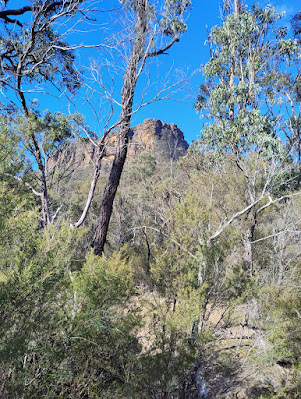
First up today,  a steep climb from Heaton's Gap along the Great North Walk and continuing along the ridge, passing Heaton's Lookout.  I then scrambled down an unnamed, steep and indistinct rocky path which eventually intersected Awabakal Road. Awabakal Road runs parallel to the eastern slopes of the Watagans, but at a much lower altitude. I kept on Awabakal Road until I was back at Leggetts Road, the main road with a short distance to my car at the gap.   Awabakal Road is now very much overgrown, badly washed out in places and difficult to negotiate on foot.   The Awabakal people are indigenous people local to this area. Awaba is the indigenous name of the nearby Lake Macquarie. (click on the pictures for more detail)

Not much left of Awabakal Road here!


Heaton's Lookout

Logging Equipment


distance: 18Km,  moving time: 3hrs,20mins, elevation: 742metre   

Tuesday, 1 July 2025

Down the Slott Way to the Nattai River returning via Starlights Track - June 2025

One of my favourites, the Nattai River. The last time I was in this area was in 2020, immediately after the extensive bush fires in the region. 
Here is my post from that time: https://oldbushrunner.blogspot.com/2020/07/wattle-ridge-troys-creek-starlights.html
The vegetation at that time was devastated, quiet eirie to witness. This time the under story had regrown and almost overgrown the tracks. 

(click on the pictures for more detail)

The Nattai is in that gorge

A fresh rockfall on the Slott way

Mt Jellore sticking up mid picture

Russells Needle

Eastern edge of the Nattai Gorge

The Nattai River

Aheaarns Lookout, between the Slott Way & Starlights Track

distance: 18.7Km,  moving time: 3hrs,41mins, elevation: 620metre