Friday, 24 December 2021

The Great North Walk - Mt Warrawolong to Flat Rock Lookout - December 2021

This months run, an 'out and back' run, was along a section of the Great North Walk the next section North from the section I did last month. The conditions on the day was warm and humid, our first taste of summer this year. I drank almost two litres of water on route. I didn't see another person on the track, I did see a few goannas and lots of different birds and no snakes.


Damaged foot bridge over the Watagan Creek

Flat Rock Lookout


Stats, 
distance: 18.8Km  
moving time: 3hr, 23min  
Elevation: 856metre
Calories:1347

Friday, 26 November 2021

The Great North Walk - The Basin to Mt Warrawolong & Return - November 2021

 Another section of the Great North Walk done this time. My turn around point was Mt Warrawolong, the highest point on the Great North Walk. Mt Warrawolong is one of the many volcanic intrusions in to the Sydney/Hawkesbury sandstone. The vegetation in the igneous soil on the mountain is much lusher than in the surrounding sandstone.  I was disappointed, there was no view from the summit due to the lush vegetation. The only wildlife of note I encountered was the tail end of snake slithering into the undergrowth.

The Track

Grass Tree

Mt Warrawolong Tower

Wollombi Brook

More of the track

Who can spot the female Blue Wren


Stats, 
distance: 25.8Km  
moving time: 4hr, 48min  
Elevation: 1158metre
Calories:1958 
 

Wednesday, 27 October 2021

Bob Turners Track to the Colo - October 2021

After being locked down for several months I felt I needed to ease back into my bush forays, Bob Turners seem suitably short and relatively easy, and it was.

As I have mentioned in previous posts, before 1900 there was a proposal to construct a train line from Penrith to Rylstone mostly along the Colo river and further west the Wolgan river. Bob Turners Track was originally a pack horse path to the river used by the surveyors at the time of the survey. The proposed rail line was surveyed but never constructed. Bob Turners was restored in 1970 and later named "Bob Turners Track" in 1979 when the Wollemi National Park was declared.  Bob Turner was a Mayor of Ku-ring-gai who was involved with the tracks restoration.

The Track

Flannel Flower with freeloader

This Fellow raced across the track

The Colo looking down stream

My first glimpse of the Colo

This is typical of the wildflowers today

Stats, 
distance: 7.7Km  
moving time: 1hr, 28min  
Elevation: 359metres  
Calories:722


Sunday, 27 June 2021

The Great North Walk - Lyrebird Trail to The Basin Campsite & Return - June 2021

 Another section of the Great North Walk completed this time. This is some distance further north from the  Cherry Lane section I did in April this year (2021). The sections between the these two tracks are mostly boring road stages, so I have been avoiding doing them and only doing the interesting bits. 

The Lyrebird Track, the first part of today's run, lived up to it's name. I sighted four male lyrebirds today, they where too quick for me to get a photograph.

In December last year (2020) I camped at the Basin Campground on the first night of the this Bike ride . Today I turned back at the Basin Campground, rather than retrace my way out along the walking trail I decided to run/walk up the steep access road to get the main road, Walkers Ridge Road. On the way up, through the trees I got a glimpse of an mangled car. I scrambled through the bush to get to it, it didn't look very old. I started worry what I might find in the wreckage, my concern was unfounded the car had been there a little longer than I initially thought. It had landed here after going over a thirty metre cliff, the main road was above the cliff. I contacted the local police a few days later. They knew about the car, it had been stolen and pushed over the cliff.

Driving through the bush on the way home a pair of feral deer raced across the road just ahead of me, I am not sure what type they were.

My start & finish

A dumped stolen car near the Basin Camp Ground


Walkers Rest Camp Site


A Novel System for opening the gate without leave the car, adjacent to the Great North Walk

Stats, 
distance: 18.5Km  
moving time: 3hr, 8min  
Elevation: 704metres  
Calories:1322


Sunday, 9 May 2021

The Trestle Track to Tolwong Mine - May 2021

This was a visit to the abandoned Tolwong mine. Copper, tin and arsenic was mined and refined here from 1910, to 1916. The refining was problematic owing to the type of mineral mined. About 1500 tonnes of refined ore was shipped from here during that time. The site was serviced by two aerial tramways (flying foxes), one went up out of the gorge to the east, the other crossed the river and, up and out of the gorge to the west. The western tramway had an altitude difference of 520 metres, the latter was used to transport the refined ore out of the gorge, the ore was then carted to the railway station at Marulan. Around sixty employees were working here.
Previously there has been some leaching of arsenic and other pollutants from the mine site into the Shoalhaven river, the mullock heaps have been covered and sealed in recent times. The Shoalhaven occasionally supplements Sydney's water supply as well as other nearby places.
Today's pictures are a little hazy due to smoke from the fuel reduction burns we have been having lately.
Further information about this mine can be found here.

Top of the Trestle Track

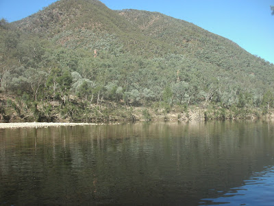
The Shoalhaven flowing out of the Blockup Gorge

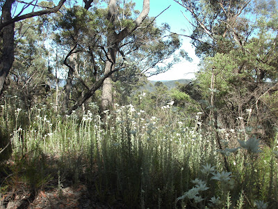
Grass Trees on the Trestle Track


Long Point is in the centre

Mine Chimneys from the West Bank of the Shoalhaven

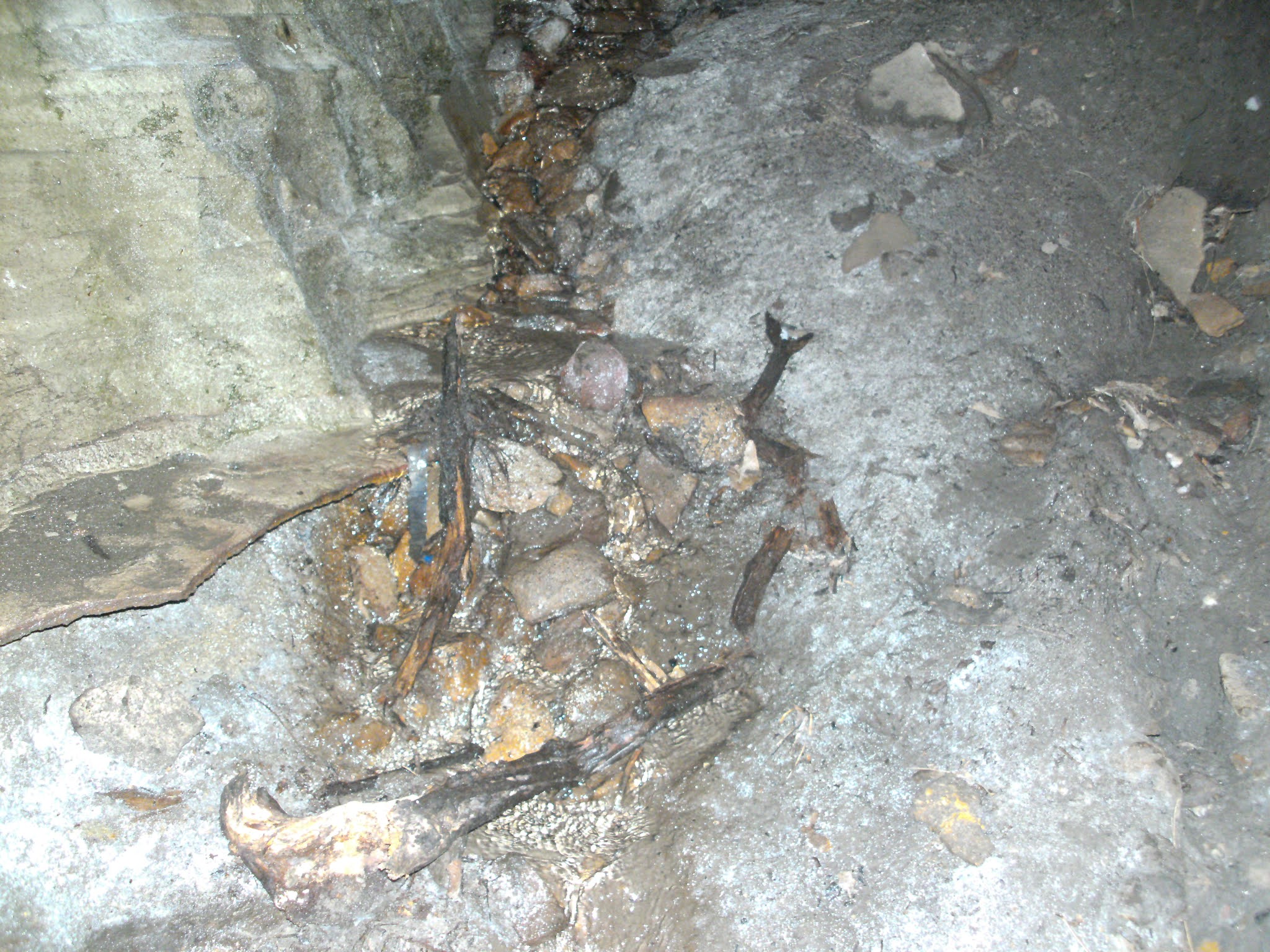
Lower Flying Fox footing the other end of flying fox was on the peak in the top of the picture


The Shoalhaven   


Stats,
distance: 14.7Km
moving time: 2hr, 46min
Elevation: 690metres
Calories:952


Tuesday, 27 April 2021

Great North Walk - Cherry Lane and Ourimbah Creek - April 2021

This run was another The Great North Walk section, part of the "Cedar Brush Track". Today I did next section further north from what I did in October 2020. Once underway I attempted to take my first photograph about 2km into the run, only to find the focus system was stuffed on my cheap Aldi camera, no doubt due to the rough times it has had in my running pack. So doubled back I did and grabbed my phone. At least now I could get some focused pictures. The resultant pictures are below.  Deep in the rain forest the phone camera was useless under low light conditions. I was unable to get any pictures in the really beautiful places, and there where where many such places today. 

Note: I am trailing a new email subscription service, Google is closing the service that I have used until now. So maybe I didn't get it correct if your subscription email looks odd, apologies if your email isn't correct.


Where I started & finished

High Voltage Transmission Lines

The start of the Rainforest


A Goanna at the campground

The Campground


Stats,
distance: 15.9Km
moving time: 2hr, 58min
Elevation: 477metres
Calories:1143

Saturday, 27 February 2021

The Devils Hole & Nellies Glenn - February 2021

I had to visit the upper mountains for other reasons for a couple of hours this day. So rather than waste my time in the mountains, I figured a revisit of this route the opposite way round to the last time I did it was in order. The Devils Hole is a steep narrow clevis in the cliffs, with some large rocks forming a roof. It is probably the quickest way into the Megalong Valley from Katoomba. I was fascinated to find some water flowing out of a cave in the wall of the 'Hole', see the picture below. Navigation is a little tricky after emerging from the Hole,  there are several tracks that peter out, otherwise it was straight forward, if a little steep, made a bit slipperier with the misty rain on the day.

Katoomba Trackhead

Devils Hole (from a previous visit)

Spring water flowing out of the rocks in the cave

One of the waterfalls near the bottom Devils Hole


Another waterfall near the bottom

Nellies Glenn

Mt Solitary & Narrow Neck
 
The Megalong Valley & Six Foot Track

Stats,
distance: 11Km
moving time: 2hr, 01min
Elevation: 622metres
Calories:727


Sunday, 24 January 2021

Gospers Ridge - Mailes Ridge - Colo Maroo Campground January 2021

When I did the following trip; Mountain Lagoon to Colo Maroo and return in 2020, I noticed a single track branch off and head East along Gospers Ridge. I had been wondering if that unmarked track continued through to the settled area of Upper Colo. So this time I parked at the Upper Colo RFS shed and took off along a rough track that headed up Gospers Ridge. I figured that if that track didn't go where I hoped it would, I would just back track to the ute and call it a day. Any way after three or four kilometers I was on the familiar Mountain Lagoon,  Colo Maroo track, near the southern end of Mailes Ridge. After traversing Mailes Ridge, like in 2020 I found it a little problematic safely descending off the Northern nose of Mailes Ridge, the track has been obliterated by the recent bushfires, after a little bum sliding I was down OK. There were a couple of bush walkers at the Colo Maroo camp ground when I arrived. This campground is only accessible by canoe, walking or bicycle. The Colo was turbid and swiftly flowing after recent heavy rains, the river water is usually crystal clear. From the campground I followed the four wheel drive track through private property, cyclists and walkers are allowed on this track, and then the public road to the RFS shed.

Colo Maroo, National Parks camp ground

White speck in the furthest grassy area is my ute. This picture was taken from the end of Mailes Ridge. 


Double Drummer (thoph saccata) said to be the loudest cicada in the world, and the largest in Australia

Notice the Colo river water is brown & well up.


The Colo much further down stream taken on the drive home
Stats,
distance: 18.6Km
moving time: 3hr, 13min
Elevation: 671metres
Calories:1262