I arrived at Dumphies to find the car park almost full, other times I have been here I have had the car park all to myself. Then the penny dropped, today was the day before ANZAC day.This is the closest car access to Splendor Rock. Many bush walkers camp overnight at Splendor Rock or nearby Mobb's Soak, so they can be at the rock at sunrise to remember fallen ANZAC bush walkers. I was thinking, this means the track would be inundated with tourist. Surprisingly after leaving the parking area I was completely on my own until I returned.

Nearly all the first section down Carlon Creek had lots of stinging nettles, I did cop a few stings, I didn't notice them while running and walking, rather on the trip home my lower legs were rather itchy, gators or long leggings next time.
A couple of these Red Bellied reptiles raised my pulse somewhat. They both seemed quite sluggish, maybe due to it being quite late in the season.

Aboriginal grinding grooves on Iron Mountain.
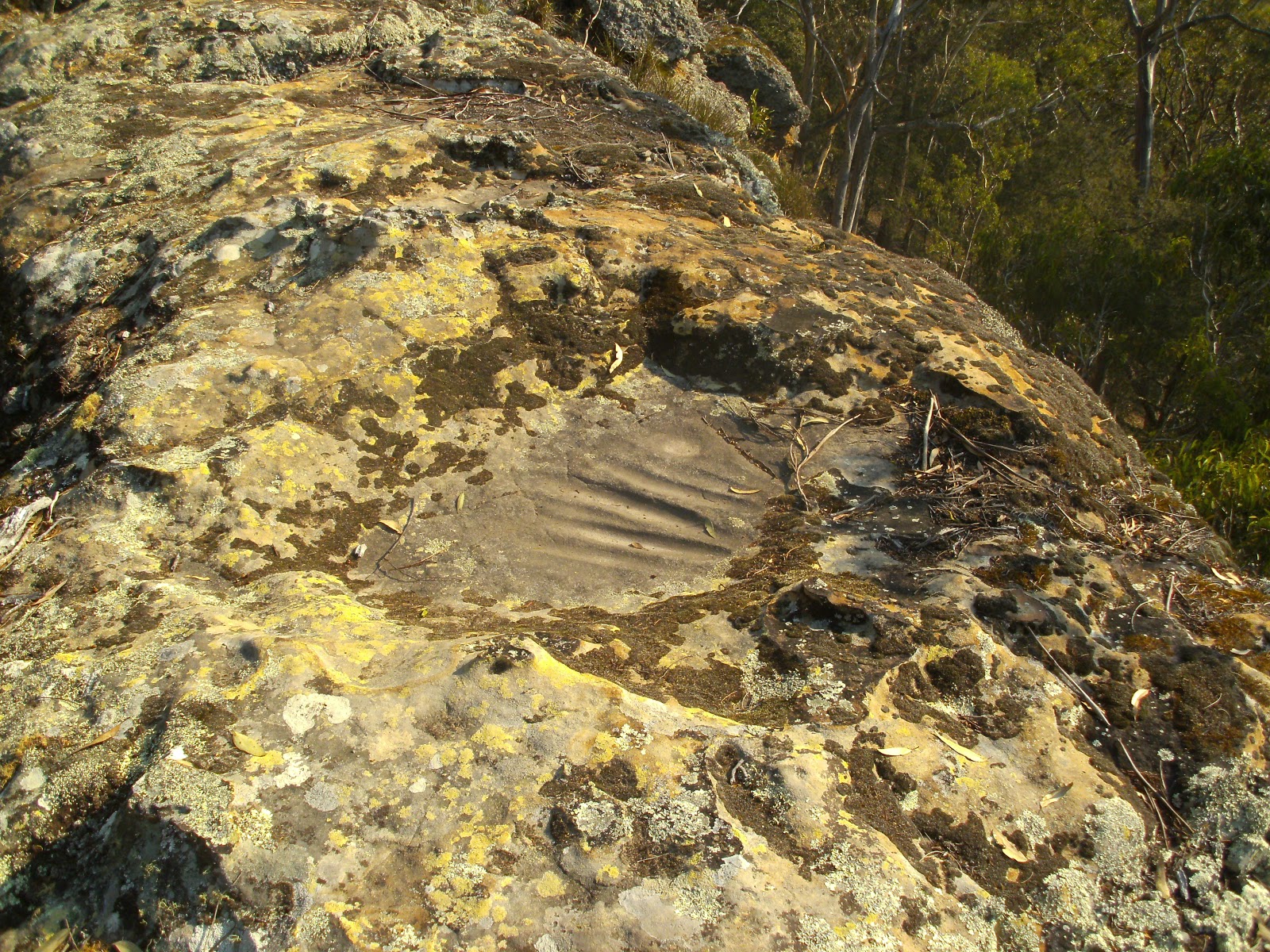
More Aboriginal masonry work, holes ground into the rock for unknown reasons, about 100mm diameter.

The Coxes River is in that gorge, taken from Iron Mountain

A large recent (within the last 2 years) rock fall taken from the Megalong road on my way home. The Hydro Magestic is the white building on the top of the cliff just to right of the rockfall.

Stats for the day: distance 16.5 Km
moving time 190 minutes
total climbing 863 metres
estimated calories 1732